Results of this analysis reflect the current standard of practice used for defining PMP, including comprehensive storm analyses procedures, extensive use of geographic information systems (GIS), explicit quantification of orographic effects, updated sea surface temperatures for storm maximization, storm specific temporal patterns, and improved understanding of the weather and climate related to extreme throughout the region.
In comparison to the HMRs and TP 42, the new study provides:
- Gridded dataset within GIS platform relies on computer analysis versus human interpretation of contours
- Reviewed 60 years of new data that resulted in including 24 new storms for analysis that were not accounted for in the HMRs
- Storm database that is continually updated
- Reproducible Results
- PMP results available for the entire island down to a single grid point
- Includes temporal and spatial distributions of PMP rainfall events
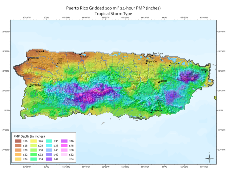
The new PMP estimates are available from a single grid point to the entire island. When compared to previous PMP depths provided in TP 42, the updated values from this study resulted in a wide range of reductions for most basin sizes and storm durations, with some regions resulting in minor increases. PMP depths are highest in mountainous terrain in the central and eastern highlands region of the island and lowest along the northwestern coast and southwestern coast. These spatial variations in PMP depth match the general weather patterns of the region related to moisture availability, topography, and storm dynamics. Data, assumptions, and analysis techniques used in this study have been reviewed and accepted by the USBR, USACE, and PREPA.


