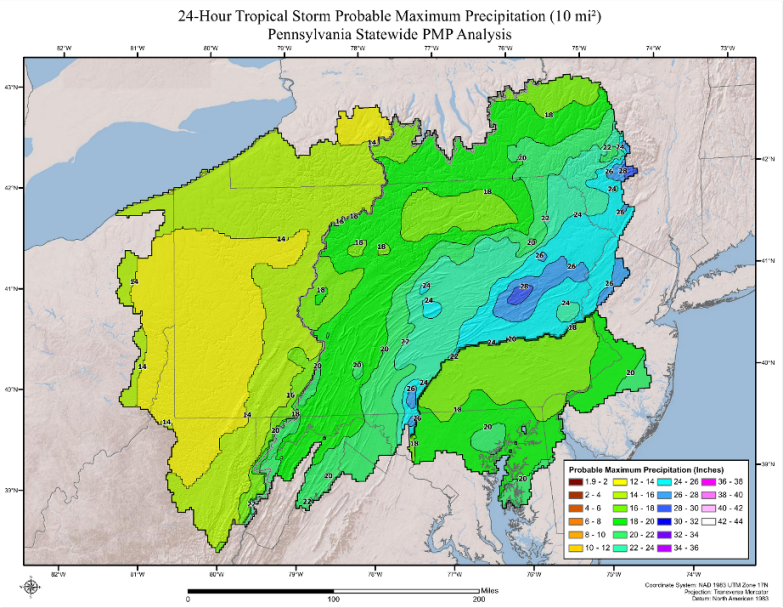
Probable Maximum Precipitation depths were developed for the state of Pennsylvania and surrounding regions. This covered thousands of dams, many of which are classified as high hazard. PMP depths for durations from 1-hour through 72-hours and included storm specific temporal patterns. The 1-hour to 6-hour durations were critical as most of the dams in Pennsylvania are small, with contributing basins less than 10-square miles where short duration rainfall events are the critical feature for dam safety. This output was not available in the previous HMR data and therefore man dams were under designed. This included a detailed reanalysis of the Smethport July 1942 world record rainfall in collaboration with Aterra Solutions. The results of that analysis are included in this article. All outputs were provided in a gridded database via AWA’s PMP tool.
In comparison to the NWS Hydrometeorological Reports 51 and 55A, the new study provides:
- Reproducible Results
- Gridded dataset within GIS platform relies on computer analysis versus human interpretation of contours
- Included 60 years of new data that resulted in including several new storms for analysis that were not accounted for in the HMRs
- PMP results island-wide
- Includes temporal distributions
- Includes gridded rainfall data for mode calibration
The new PMP estimates are available for the entire region, down to a single grid level. This information allows for hydrologic analyses to be completed for any location and for all durations.
When compared to previous PMP depths, the updated values from this study resulted in a wide range of reductions for most basin sizes and storm durations, with some regions resulting in minor increases. PMP depths are highest along the slopes of the Appalachians where the elevated terrain plays a major role in rainfall enhancement. These spatial variations in PMP depth, match the general weather patterns of the region related to moisture availability, topography, and storm dynamics.
Data, assumptions, and analysis techniques used in this study have been reviewed and accepted by the by an independent board of reviewers, as well as study participants from the PA DEP, USACE, NRCS, and FERC.


